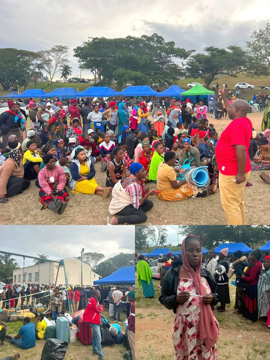
Heavy rainfall has battered Cape Town over the past 24 hours, leaving disaster management teams scrambling to assess the damage across multiple vulnerable communities and raising fresh concerns about informal settlements’ resilience to extreme weather events. The downpours, which persisted into Sunday and threatened to continue into the early hours of Monday, triggered a coordinated response from the City’s Disaster Risk Management unit, with teams fanning out across hard-hit areas to evaluate the scale of structural damage and coordinate emergency relief efforts.
Disaster Risk Management spokesperson Sonica Lategan confirmed that officials were deployed on the ground in two particularly affected zones: Mkhonto Square Informal Settlement in Nyanga and Brown’s Farm, where initial reports suggested that numerous structures had been compromised by the relentless downpours. The spokesperson noted that while damage reports had flooded in, the full picture was still emerging as field teams worked through Sunday conducting detailed assessments. Lategan explained that the Disaster Operations Centre had fielded multiple reports of structural impacts, but authorities were keen to avoid speculation until proper inspections could determine the exact extent of harm to residents’ homes and facilities.
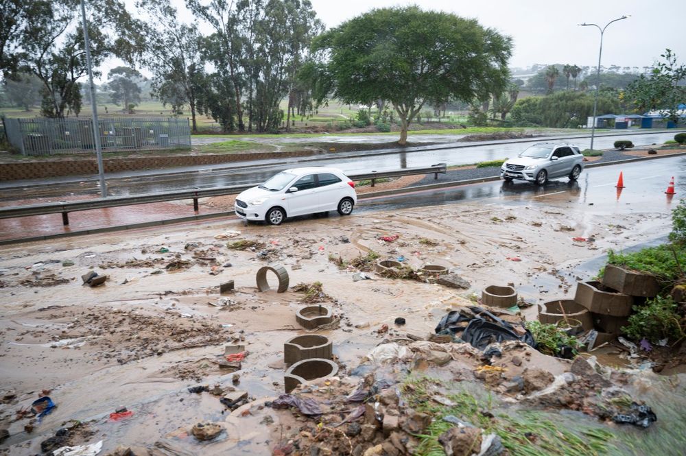
The scope of disruption extended well beyond the informal settlements, with widespread localised flooding reported right across the Cape Town metropolitan area. Authorities documented several flooding incidents requiring urgent intervention, with details being relayed to the Transport Management Centre to mobilise Roads and Stormwater teams to priority zones. Several roads in Parkwood were among the hardest hit, though flooding was scattered across numerous suburbs as drainage systems struggled to cope with the volume of water cascading through the city’s streets and open spaces.
Weather forecasters had warned residents to prepare for the onslaught, and those predictions held true as the system moved through the region with considerable force. The South African Weather Service confirmed that a distinct cold front had swept across the south-western Western Cape, generating rainfall totals expected between 30mm and 60mm, with the heaviest concentrations likely over mountainous terrain where orographic effects intensify precipitation.
Cape Town’s Disaster Risk Management response to unprecedented weather patterns
The mountainous regions around Cape Town experienced more than just rain, with the Matroosberg Nature Reserve reporting that snow had begun accumulating over the Worcester mountain range, though accumulation was limited to the highest peaks. The reserve posted social media updates confirming that conditions had turned “cold and stormy,” with hiking trails subsequently closed to ensure visitor safety while severe weather persisted. Despite the dramatic conditions, the reserve noted that snow coverage remained concentrated at the summits, with lower-lying areas spared the white stuff.
What makes this particular weather event significant is how it illustrates the ongoing vulnerability of Cape Town’s informal settlements to extreme weather, a pattern we’ve been tracking closely at SA Report over recent years. Communities like Mkhonto Square and Brown’s Farm have repeatedly found themselves in the firing line when weather systems move through the Western Cape, with inadequate drainage infrastructure and substandard housing construction leaving residents exposed to flooding, structural collapse, and displacement.
Authorities have urged residents across the affected areas to maintain heightened vigilance and minimise unnecessary movement through flooded zones, sound advice given how quickly conditions can deteriorate when drainage becomes overwhelmed. The Public Emergency Communications Centre has been made available for residents needing to report emergencies, with the number 021 480 7700 circulated to the public for immediate use should incidents require urgent intervention from emergency services.
As the immediate crisis unfolded, city officials were simultaneously coordinating with multiple departments to ensure rapid response and recovery support. The coordination between Disaster Risk Management, Roads and Stormwater, and the Transport Management Centre highlighted how integrated city responses have become when managing weather-related emergencies. Yet questions persist about whether the infrastructure investments match the scale of vulnerability, particularly in informal settlements where residents have few alternatives when severe weather strikes.
The forecast suggesting adverse weather would linger through to Monday morning meant residents faced a tense overnight period monitoring conditions and hoping that drainage systems could eventually catch up with incoming water. For those living in vulnerable structures, the night ahead represented genuine anxiety, and the deployment of assessment teams offered at least some reassurance that their situations would be documented and accounted for in the broader disaster response effort.